AAU Herbarium Database |
| New Search Modify Search |
| Collector | Balslev, H. |
| Number | 7946 |
| Collected with | C. Grandez, D. Pedersen, B. Bergmann, G. del Aguila Panduro, Jim Chilo, A. Alvarado & J. Gonzales Baardales |
| Country | Peru |
| Subpart | Loreto |
| County | |
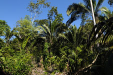
| Locality | Río Ucayali, 46 km SW of Contamana, 101 km NW of Pucallpa. S side of Río Pisqui, near the village of Santa Rosa. Severely logged forest with many tractor tracks. UTM 18M: 481906; 9144880 |
| Coordinates | 7° 44' 9'' S 75° 9' 50'' W |
| Minimum elevation (m) | 162 |
| Maximum elevation (m) | 0 |
| Start date | 2009/06/13 |
| End date | 0/00/00 |
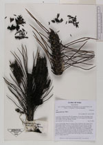
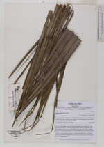
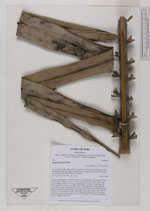
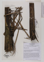
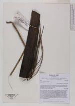
| Family | Arecaceae |
| Identification | Attalea cephalotus Poepp. ex Mart. |
| Determined by | A. Henderson (NY) |
| Identification qualifier | |
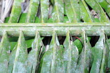
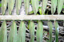
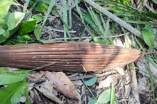
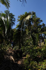
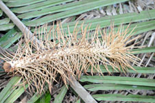
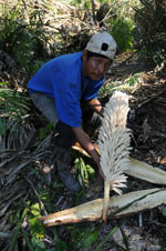
| Field notes | Solitary canopy palm. Stem 8.9 m long, 25 cm in diameter, with "spines" from old leaf bases. Number of leaves 20; leaf sheath open, more than 66 cm long; petiole absent; rachis 7.22 m long; lamina pinnate; number of pinnae per side 176, regularly inserted, in one single plane, basal pinna 133 cm long, middle pinna 130 cm long, apical pinna 60 cm long. Old inflorescence interfoliar, male, without flowers: Peduncular bract more than 164 cm long; rachis more than 54 cm long, 3 cm in diameter; number of rachillae more than 430, to 12 cm long. Inflorescence bud, not yet opened: Bract 144 cm long, 23 cm wide. HB transect no. 372, outside subunit 38 |
| |
 Other records of Attalea cephalotus Other records of Attalea cephalotusThe map displays only records from the Aarhus Herbarium Database. The records may not represent the full distribution of Attalea cephalotus |
| New Search Modify Search |