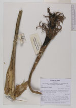
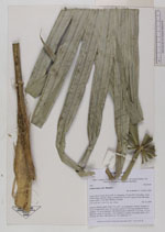
| Collector | Balslev, H. |
| Number | 7945 |
| Collected with | C. Grandez, D. Pedersen, B. Bergmann, G. del Aguila Panduro, Jim Chilo, A. Alvarado & J. Gonzales Baardales |
| Country | Peru |
| Subpart | Loreto |
| County | |
| Locality | Río Ucayali, 46 km SW of Contamana, 101 km NW of Pucallpa. S side of Río Pisqui, near the village of Santa Rosa. Severely logged forest with many tractor tracks. UTM 18M: 481868; 9144902 |
| Coordinates | 7° 44' 9'' S 75° 9' 52'' W |
| Minimum elevation (m) | 158 |
| Maximum elevation (m) | 0 |
| Start date | 2009/06/13 |
| End date | 0/00/00 |
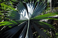
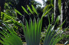
| Family | Arecaceae |
| Identification | Chelyocarpus ulei Dammer |
| Determined by | Balslev H. |
| Identification qualifier | |
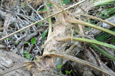
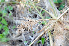
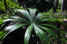
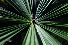
| Field notes | Solitary midstory palm. Stem 1.9 m tall, 7 cm in diameter, smooth. Number of leaves 9; leaf sheath open, 19 cm long; petiole 170 cm long, margined; lamina palmate, 155 cm in diameter. Old Infructescence: peduncle 25 cm long, 2 cm in diameter; rachis 14 cm long, 2 cm in diameter; number of rachillae aprox. 60, 7 cm long. No fruits. HB transect no. 372, subunit no. 31 |
|