AAU Herbarium Database |
| New Search Modify Search |
| Collector | Balslev, H. |
| Number | 7943 |
| Collected with | C. Grandez, D. Pedersen, B. Bergmann, G. del Aguila Panduro, Jim Chilo, A. Alvarado & J. Gonzales Baardales |
| Country | Peru |
| Subpart | Loreto |
| County | |
| Locality | Río Ucayali, 46 km SW of Contamana, 103 km NW of Pucallpa. S side of Río Pisqui. Disturbed forest (tractor tracks). UTM 18M: 479369; 9145699 |
| Coordinates | 7° 43' 43'' S 75° 11' 13.5'' W |
| Minimum elevation (m) | 139 |
| Maximum elevation (m) | 0 |
| Start date | 2009/06/13 |
| End date | 0/00/00 |
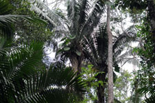
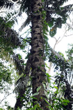
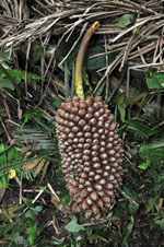
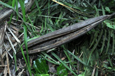
| Family | Arecaceae |
| Identification | Attalea cephalotus Poepp. ex Mart. |
| Determined by | A. Henderson (NY) |
| Identification qualifier | |
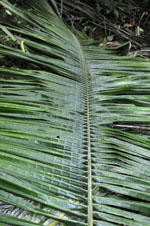
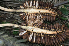
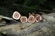
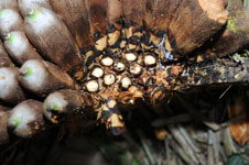
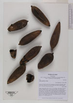
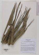
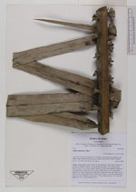
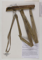
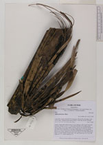
| Field notes | Solitary canopy palm. Stem 8 m tall, 27 cm in diameter, with "spines" from old leaf bases. Number of leaves 15; leaf sheath more than 120 cm long; petiole absent; rachis 750 cm long; number of pinnae 198 per side, regularly inserted, in one single plane, basal pinna 124 cm long, middle pinna 114 cm long, apical pinna 42 cm long. Infructescence interfoliar; peduncular bract more than 125 cm long, brown, woody; peduncle more than 54 cm long, 4.2 cm wide; rachis 46 cm long, 8 cm wide. Number of fruits aprox. 300, each fruit brown, 10 x 5 cm. HB transect no. 371, outside subunit no. 23 |
| |
 Other records of Attalea cephalotus Other records of Attalea cephalotusThe map displays only records from the Aarhus Herbarium Database. The records may not represent the full distribution of Attalea cephalotus |
| New Search Modify Search |