| Collector | Balslev, H. |
| Number | 7940 |
| Collected with | C. Grandez, D. Pedersen, B. Bergmann, G. del Aguila Panduro, Jim Chilo, A. Alvarado & J. Gonzales Baardales |
| Country | Peru |
| Subpart | Loreto |
| County | |
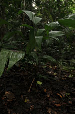
| Locality | Río Ucayali, 57 km SW of Contamana, 102 km NW of Pucallpa. S side of Río Pisqui. Disturbed primary forest (many tractor tracks). UTM 18M: 473092; 9137398 |
| Coordinates | 7° 48' 13.2'' S 75° 14' 38.6'' W |
| Minimum elevation (m) | 159 |
| Maximum elevation (m) | 0 |
| Start date | 2009/06/12 |
| End date | 0/00/00 |
| Family | Arecaceae |
| Identification | Geonoma brongniartii Mart. |
| Determined by | Balslev H. |
| Identification qualifier | |
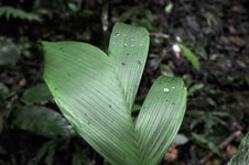
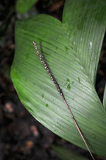
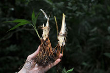
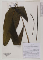
| Field notes | Cespitose understory palm. Stem 4 cm tall, 2 cm in diameter. Number of leaves 7; sheath open, 7 cm long; petiole 31 cm long, margined; rachis 31 cm long; lamina 23 cm wide, 53 cm long, some leaves entire, some leaves splitting up in 1-3 segments per side. Inflorescence (old, dry) interfoliar; peduncle 35 cm; spike 10 cm long. HB transect no. 370, subunit no. 79 |
|