AAU Herbarium Database |
| New Search Modify Search |
| Collector | Balslev, H. |
| Number | 7937 |
| Collected with | C. Grandez, D. Pedersen, B. Bergmann, G. del Aguila Panduro, Jim Chilo, A. Alvarado & J. Gonzales Baardales |
| Country | Peru |
| Subpart | Loreto |
| County | |
| Locality | Río Ucayali, 57 km SW of Contamana, 102 km NW of Pucallpa. S side of Río Pisqui. Disturbed primary forest (many tractor tracks). UTM 18M: 472978; 9137400 |
| Coordinates | 7° 48' 13.2'' S 75° 14' 42.3'' W |
| Minimum elevation (m) | 162 |
| Maximum elevation (m) | 0 |
| Start date | 2009/06/12 |
| End date | 0/00/00 |
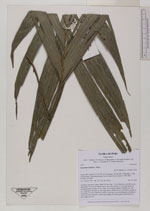
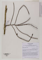
| Family | Arecaceae |
| Identification | Geonoma laxiflora Mart. |
| Determined by | Balslev H. |
| Identification qualifier | |
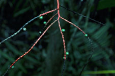
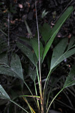
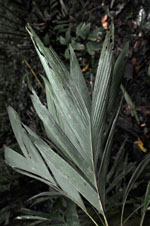
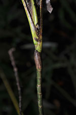
| Field notes | Cespitose understory palm. Stem 230 cm long, 1 cm in diameter, smooth, green; internodes 14 cm long. Sheath open, 6 cm long; petiole 13 cm long; rachis 24 cm long; lamina pinnate, 22 cm wide, 51 cm long; number of pinnae per side 2-3, irregularly inserted, in one single plane. Infructescence infrafoliar; peduncle 4 cm long, 0.5 cm in diameter; rachis 4 cm long, 0.4 cm in diameter; rachillae 6, 27-29 cm long; peduncle, rachis and rachilla red. Fruits green. HB transect no. 370, subunit no. 54 |

| |
 Other records of Geonoma laxiflora Other records of Geonoma laxifloraThe map displays only records from the Aarhus Herbarium Database. The records may not represent the full distribution of Geonoma laxiflora |
| New Search Modify Search |