| Collector | Balslev, H. |
| Number | 7935 |
| Collected with | C. Grandez, D. Pedersen, B. Bergmann, G. del Aguila Panduro, Jim Chilo, A. Alvarado & J. Gonzales Baardales |
| Country | Peru |
| Subpart | Loreto |
| County | |
| Locality | Río Ucayali, 57 km SW of Contamana, 102 km NW of Pucallpa. S side of Río Pisqui. Disturbed primary forest (many tractor tracks). UTM 18M: 472718; 9137394 |
| Coordinates | 7° 48' 13.4'' S 75° 14' 50.8'' W |
| Minimum elevation (m) | 152 |
| Maximum elevation (m) | 0 |
| Start date | 2009/06/12 |
| End date | 0/00/00 |
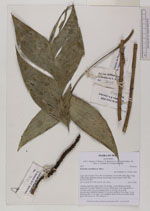
| Family | Arecaceae |
| Identification | Geonoma arundinacea Mart. |
| Determined by | Balslev H. |
| Identification qualifier | |
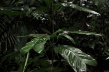
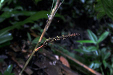
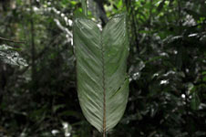
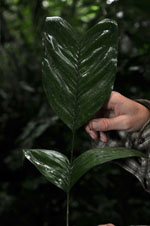
| Field notes | Cespitose understory palm. Stem 103 cm long, 1 cm in diameter, smooth; internodes 4 cm long. Number of leaves 8; sheath open, 5 cm long; petiole 13 cm long; rachis 26 cm long; lamina entire, 32 cm long, 14 cm wide. Infructescence infrafoliar; prophyll 4.5 cm long; peduncle 45 cm long, 1 cm in diameter; spike 12 cm long, 1 cm in diameter, green. Fruits, not mature, small, green. HB transect no. 370, subunit no. 5 |
|