| Collector | Balslev, H. |
| Number | 7934 |
| Collected with | C. Grandez, D. Pedersen, B. Bergmann, G. del Aguila Panduro, Jim Chilo, A. Alvarado & J. Gonzales Baardales |
| Country | Peru |
| Subpart | Loreto |
| County | |
| Locality | Río Ucayali, 57 km SW of Contamana, 102 km NW of Pucallpa. S side of Río Pisqui. Disturbed primary forest (many tractor tracks). UTM 18M: 472697; 9137391 |
| Coordinates | 7° 48' 13.5'' S 75° 14' 51.5'' W |
| Minimum elevation (m) | 153 |
| Maximum elevation (m) | 0 |
| Start date | 2009/06/12 |
| End date | 0/00/00 |
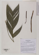
| Family | Arecaceae |
| Identification | Geonoma arundinacea Mart. |
| Determined by | Balslev H. |
| Identification qualifier | |
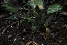
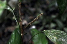
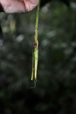
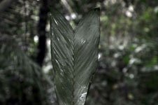
| Field notes | Cespitose understory palm. Stem 30 cm long, 1 cm in diameter, smooth, partly covered by old leaf sheaths; internodes 5 cm long. Number of leaves 11; sheath 6 cm long; petiole 16 cm long; rachis 20 cm long; lamina entire, 27 cm long, 10 cm wide. Inflorescence infrafoliar; prophyll 4 cm long; peduncle 45 cm long, 0.3 cm in diameter; spike 55 cm long, 0.5 cm in diameter, green. Flower buds sunken. HB transect no. 370, subunit no. 1 |
|