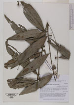
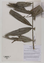
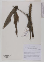
| Collector | Balslev, H. |
| Number | 7923 |
| Collected with | C. Grandez, D. Pedersen, B. Bergmann, G. del Aguila Panduro, Jim Chilo, A. Alvarado & J. Gonzales Baardales |
| Country | Peru |
| Subpart | Loreto |
| County | |
| Locality | Río Ucayali, 60 km SW of Contamana, 106 km NW of Pucallpa, Nueva Bellaunde. S side of Río Pisqui. Flat, rarely inundated ground. Disturbed forest with many tractor tracks. UTM 18M: 466787; 9136771 |
| Coordinates | 7° 48' 33.5'' S 75° 18' 4.5'' W |
| Minimum elevation (m) | 178 |
| Maximum elevation (m) | 0 |
| Start date | 2009/06/11 |
| End date | 0/00/00 |
| Family | Arecaceae |
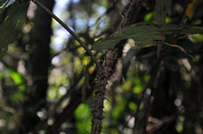
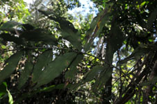
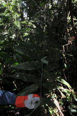
| Identification | Desmoncus polyacanthos var. polyacanthos Mart. |
| Determined by | Balslev H. |
| Identification qualifier | |
| Field notes | Liana. Stem 8 m long, 1.2 cm in diameter. Leaves pinnate; petiole 3 cm long; rachis 105 cm long; number of pinnae per side 12, inserted in groups of 1-3, basal pinna 21 cm long, middle pinna 22 cm long, apical pinna 27 cm long; sheath, petiole and rachis with brown spines. Sterile. HB transect no. 369, subunit no. 6 |
|
 Other records of Desmoncus polyacanthos var. polyacanthos