| Collector | Balslev, H. |
| Number | 7922 |
| Collected with | C. Grandez, D. Pedersen, B. Bergmann, G. del Aguila Panduro, Jim Chilo, A. Alvarado & J. Gonzales Baardales |
| Country | Peru |
| Subpart | Loreto |
| County | |
| Locality | Río Ucayali, 60 km SW of Contamana, 106 km NW of Pucallpa, Nueva Bellaunde. S side of Río Pisqui. Flat, rarely inundated ground. Disturbed forest with many tractor tracks. UTM 18M: 466750; 9136786 |
| Coordinates | 7° 48' 33'' S 75° 18' 5.7'' W |
| Minimum elevation (m) | 156 |
| Maximum elevation (m) | 0 |
| Start date | 2009/06/11 |
| End date | 0/00/00 |
| Family | Arecaceae |
| Identification | Geonoma laxiflora Mart. |
| Determined by | Balslev H. |
| Identification qualifier | |
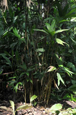
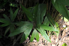
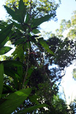
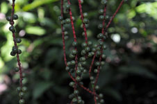
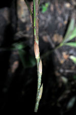
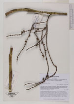
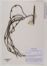
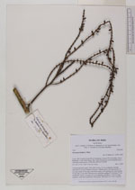
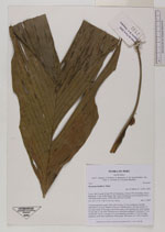
| Field notes | Colonial understory palm. Stem 240 cm long, 1.5 cm in diameter, smooth; internodes 8 cm long. Number of leaves 9; sheath open, 8 cm long; petiole 14 cm long; rachis 26 cm long; some leaves entire, some splitting up; entire lamina, 55 cm long, 23 cm wide. Infructescence infrafoliar; peduncle 5 cm long, 0.7 cm in diameter; rachis 5 cm long, 0.5 cm in diameter; rachillae 6, 37-38 cm long; peduncle, rachis and rachilla red. Fruits green. HB transect no. 369, to transect |

|
 Other records of Geonoma laxiflora