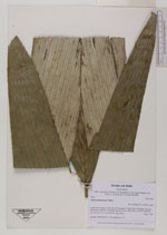
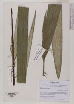
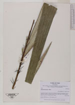
| Collector | Balslev, H. |
| Number | 7920 |
| Collected with | C. Grandez, D. Pedersen, B. Bergmann, G. del Aguila Panduro, Jim Chilo, A. Alvarado & J. Gonzales Baardales |
| Country | Peru |
| Subpart | Loreto |
| County | |
| Locality | Río Ucayali, 31 km SE of Contamana, 95 km NW of Pucallpa. 6 km up Quebrada Cashiboya. Disturbed primary forest. UTM 18M: 510573; 9158729 |
| Coordinates | 7° 36' 38.8'' S 74° 54' 14.9'' W |
| Minimum elevation (m) | 148 |
| Maximum elevation (m) | 0 |
| Start date | 2009/06/09 |
| End date | 0/00/00 |
| Family | Arecaceae |
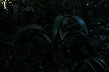
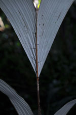
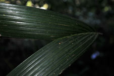
| Identification | Astrocaryum jauari Mart. |
| Determined by | Balslev H. |
| Identification qualifier | |
| Field notes | Juvenile. HB transect no. 368, subunit no. 55 |
|
 Other records of Astrocaryum jauari