AAU Herbarium Database |
| New Search Modify Search |
| Collector | Balslev, H. |
| Number | 7918 |
| Collected with | C. Grandez, D. Pedersen, B. Bergmann, G. del Aguila Panduro, Jim Chilo, A. Alvarado & J. Gonzales Baardales |
| Country | Peru |
| Subpart | Loreto |
| County | |
| Locality | Río Ucayali, 31 km SE of Contamana, 95 km NW of Pucallpa. 6 km up Quebrada Cashiboya. Disturbed primary forest. UTM 18M: 510686; 9158562 |
| Coordinates | 7° 36' 44.3'' S 74° 54' 11.2'' W |
| Minimum elevation (m) | 141 |
| Maximum elevation (m) | 0 |
| Start date | 2009/06/09 |
| End date | 0/00/00 |
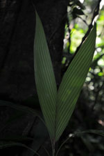
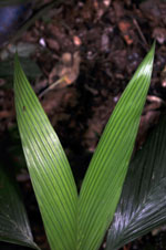
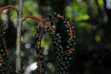
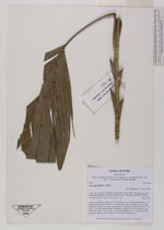
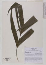
| Family | Arecaceae |
| Identification | Geonoma laxiflora Mart. |
| Determined by | Balslev H. |
| Identification qualifier | |
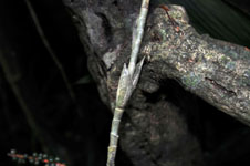
| Field notes | Cespitose understory palm. Stem 60 cm long, 1 cm in diameter; internodes 2 cm long, smooth. Number of leaves 7; sheath open, 5 cm long; petiole 11 cm long, margined; rachis 19 cm long; lamina entire or splitting up; entire lamina 42.5 cm long, 22 cm wide. Infructescence infrafoliar; peduncle 3.5-4.5 cm long, 0.5 cm wide, red; rachis 1-2.5 cm long, 0.4 cm wide; rachillae 4, 21-24 cm long. Fruits dark green, globose. HB transect no. 368, outside subunit no. 17 |


| |
 Other records of Geonoma laxiflora Other records of Geonoma laxifloraThe map displays only records from the Aarhus Herbarium Database. The records may not represent the full distribution of Geonoma laxiflora |
| New Search Modify Search |