AAU Herbarium Database |
| New Search Modify Search |
| Collector | Balslev, H. |
| Number | 7912 |
| Collected with | C. Grandez, D. Pedersen, B. Bergmann, G. del Aguila Panduro, Jim Chilo, A. Alvarado & J. Gonzales Baardales |
| Country | Peru |
| Subpart | Loreto |
| County | |
| Locality | Río Ucayali, 23 km SW of Contamana, 113 km NW of Pucallpa. App. 20 km from the village of Santa Rosa. W side of oxbow lake. Primary forest. UTM 18M: 491787; 9167689 |
| Coordinates | 7° 31' 47.1'' S 75° 4' 28'' W |
| Minimum elevation (m) | 141 |
| Maximum elevation (m) | 0 |
| Start date | 2009/06/08 |
| End date | 0/00/00 |
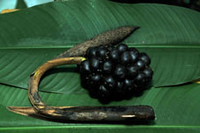
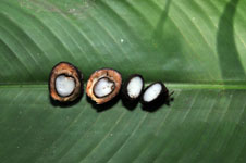
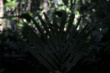
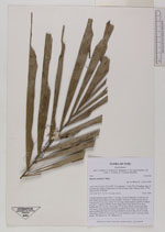
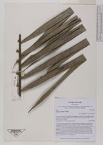
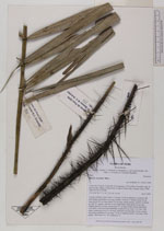
| Family | Arecaceae |
| Identification | Bactris concinna Mart. |
| Determined by | Balslev H. |
| Identification qualifier | |
| Field notes | Colonial midstory palm. Stem 1.1 m long, 3.8 cm in diameter, covered by old leaf sheaths; internodes 6 cm long. Number of leaves 7; sheath closed, 40 cm long; petiole 80 cm long; rachis 125 cm long; lamina pinnate; number of pinnae per side 37, regulary inserted, in one single plane, basal pinna 38 cm long, middle pinna 45 cm long, apical pinna 23 cm long; sheath, petiole and rachis with spines. Infructescence interfoliar; prophyll 20 cm long, 2 cm wide, with spines; peduncular bract 29 cm long, inserted 8 cm from base, brown, woody, with spines; peduncle 29 cm long, 1.4 cm in diameter; rachis 7 cm long. Fruits purple . HB transect no. 367, subunit no. 9 |

| |
| Display all 48 georeferenced records of Bactris Bactris concinna |
| New Search Modify Search |