| Collector | Balslev, H. |
| Number | 7909 |
| Collected with | C. Grandez, D. Pedersen, B. Bergmann, G. del Aguila Panduro, Jim Chilo, A. Alvarado & J. Gonzales Baardales |
| Country | Peru |
| Subpart | Loreto |
| County | |
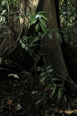
| Locality | Río Ucayali, 17 km SW of Contamana, 115 km NW of Pucallpa. App. 25 km from the village of Santa Rosa, N side of river. Primary forest. UTM 18M: 492513; 9171414 |
| Coordinates | 7° 29' 45.8'' S 75° 4' 4.3'' W |
| Minimum elevation (m) | 128 |
| Maximum elevation (m) | 0 |
| Start date | 2009/06/08 |
| End date | 0/00/00 |
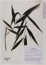
| Family | Arecaceae |
| Identification | Desmoncus polyacanthos var. polyacanthos Mart. |
| Determined by | Balslev H. |
| Identification qualifier | |
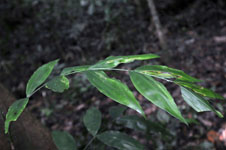
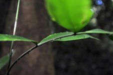
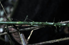
| Field notes | Colonial liana palm. Stem 2 m long. Number of leaves 12, distributed along the stem; sheath 10 cm long, closed; petiole 8 cm long; rachis 53 cm long; lamina pinnate, flat; number of pinnae per side 7, regularly inserted, basal pinna 7.5 cm long, middle pinna 14 cm long, apical pinna 11.5 cm long; sheath, petiole and rachis with black spines. Sterile voucher. HB transect no. 366, subunit no. 6 |
|
 Other records of Desmoncus polyacanthos var. polyacanthos