AAU Herbarium Database |
| New Search Modify Search |
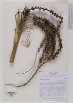
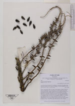
| Collector | Balslev, H. |
| Number | 7907 |
| Collected with | C. Grandez, D. Pedersen, B. Bergmann, G. del Aguila Panduro, Jim Chilo, A. Alvarado & J. Gonzales Baardales |
| Country | Peru |
| Subpart | Loreto |
| County | |
| Locality | Río Ucayali, 18 km SW of Contamana, 120 km NW of Pucallpa. E side of the river. Primary forest, temporary inundated. UTM 18M: 486994; 9173703 |
| Coordinates | 7° 28' 31.2'' S 75° 7' 4.4'' W |
| Minimum elevation (m) | 144 |
| Maximum elevation (m) | 0 |
| Start date | 2009/06/07 |
| End date | 0/00/00 |
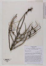
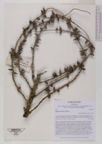
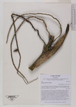
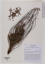
| Family | Arecaceae |
| Identification | Syagrus sancona Karsten |
| Determined by | Balslev H. |
| Identification qualifier | |
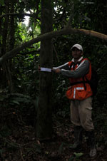
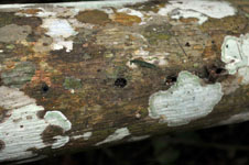
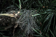
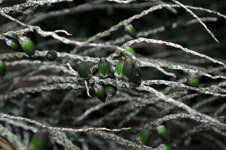
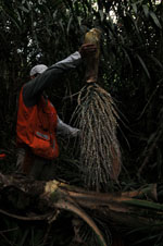
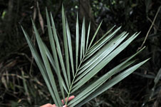
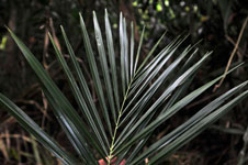
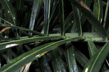
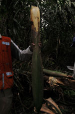
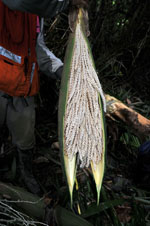
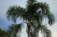
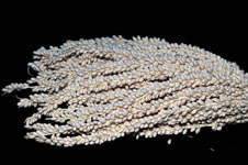
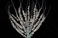
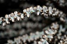
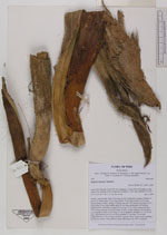
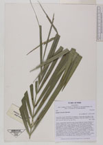
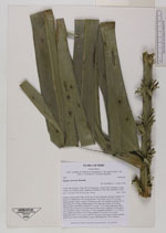
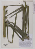
| Field notes | Solitary canopy palm. Stem 20 m long, 20 cm in diameter, fissured. Number of leaves 18; sheath open, 50 cm long; petiole 79 cm long; rachis 274 cm long; lamina pinnate, bushy; number of pinnae per side 145, inserted in groups of 2-5, basal pinna 69 cm long, middle pinna 81 cm long, apical pinna 18 cm long. Infructescence interfoliar; prophyll 59 cm long, 13 cm wide; peduncular bract 120 cm long, inserted 15 cm from base, brown, woody; peduncle 35 cm long, 5 cm in diameter; rachis 75 cm long, 2.5 cm in diameter; rachillae 112, 21-46 cm long. Inflorescence bud 134 cm long; prophyll 57 cm long, 10 cm wide; peduncular bract 132 cm long, inserted 2 cm above base, green; rachis, rachillae and flowers cream. Fruits globose, green. HB transect no. 365, to transect |
| |
 Other records of Syagrus sancona Other records of Syagrus sanconaThe map displays only records from the Aarhus Herbarium Database. The records may not represent the full distribution of Syagrus sancona |
| New Search Modify Search |