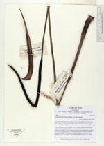
| Collector | Balslev, H. |
| Number | 7896 |
| Collected with | C. Grandez, D. Pedersen, B. Bergmann, G. del Aguila Panduro, Jim Chilo, A. Alvarado & J. Gonzales Baardales |
| Country | Peru |
| Subpart | Loreto |
| County | |
| Locality | Río Ucayali, 8 km SE of Contamana, 121 km NW of Pucallpa, ca. 2 km NE of the river. Primary forest on hilly slopes. UTM 18M: 505767; 9184577 |
| Coordinates | 7° 22' 37.1'' S 74° 56' 51.9'' W |
| Minimum elevation (m) | 177 |
| Maximum elevation (m) | 177 |
| Start date | 2009/06/05 |
| End date | 0/00/00 |
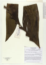
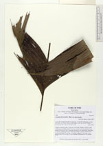
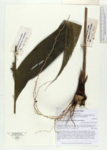
| Family | Arecaceae |
| Identification | Geonoma macrostachys var. macrostachys Mart. |
| Determined by | H. Balslev |
| Identification qualifier | |
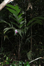
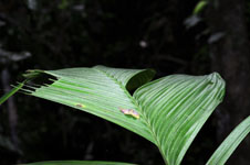
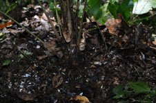
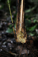
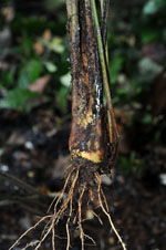
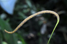
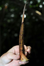
| Field notes | Cespitose understory palm. Acaulecent, 160 cm tall. Number of leaves 9; leaf sheath open, 7 cm long; petiole 71 cm long; rachis 64 cm long; lamina pinnate; number of pinnae per side 6, irregularly inserted, in one single plane, basal pinna 35 cm long, middle pinna 40 cm long, apical pinna 39 cm long. Inflorescence interfoliar; prophyll 14 cm long, 1.5 cm thick; peduncle 74 cm long, 1 cm in diameter; rachis 30 cm long, 1.5 cm in diameter. HB transect no. 362, subunit no. 79 |
|