| Collector | Balslev, H. |
| Number | 7895 |
| Collected with | C. Grandez, D. Pedersen, B. Bergmann, G. del Aguila Panduro, Jim Chilo, A. Alvarado & J. Gonzales Baardales |
| Country | Peru |
| Subpart | Loreto |
| County | |
| Locality | Río Ucayali, 8 km SE of Contamana, 121 km NW of Pucallpa, ca. 2 km NE of the river. Primary forest on hilly slopes. UTM 18M: 505724; 9184566 |
| Coordinates | 7° 22' 37.5'' S 74° 56' 53.3'' W |
| Minimum elevation (m) | 175 |
| Maximum elevation (m) | 175 |
| Start date | 2009/06/05 |
| End date | 0/00/00 |
| Family | Arecaceae |
| Identification | Geonoma arundinacea Mart. |
| Determined by | Balslev H. |
| Identification qualifier | |
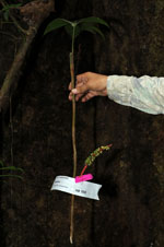
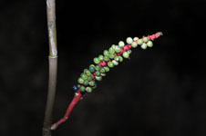
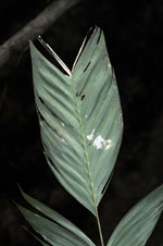
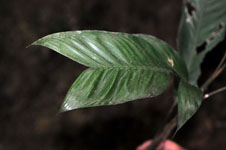
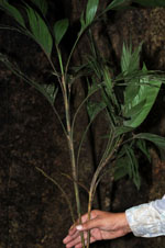
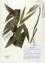
| Field notes | Cespitose understory palm. Stem 125 cm long, 1 cm in diameter, smooth. Number of leaves 7; leaf sheath 9 cm long; petiole 13 cm long, section round; rachis 29 cm long; lamina entire or pinnate; pinnae 1-5 per side, irregularly arranged, in one single plane. Infructescence interfoliar; peduncle 4 cm long, 0.5 cm thick; spike 17 cm long, 0.8 cm in diameter, red. Fruits green turning black. HB transect no. 362, subunit no. 67 |
|