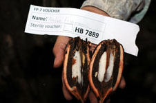
| Collector | Balslev, H. |
| Number | 7889 |
| Collected with | C. Grandez, D. Pedersen, B. Bergmann, G. del Aguila Panduro, Jim Chilo, A. Alvarado & J. Gonzales Baardales |
| Country | Peru |
| Subpart | Loreto |
| County | |
| Locality | Río Ucayali, 8 km SE of Contamana, 121 km NW of Pucallpa, ca. 2 km NE of the river. Primary forest on hilly slopes. UTM 18M: 505500; 9184509 |
| Coordinates | 7° 22' 39.3'' S 74° 57' .6'' W |
| Minimum elevation (m) | 199 |
| Maximum elevation (m) | 199 |
| Start date | 2009/06/05 |
| End date | 0/00/00 |
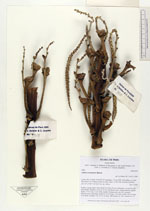
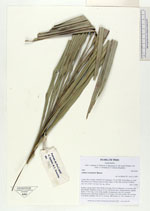
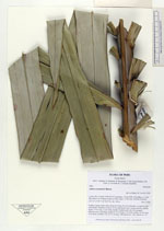
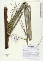
| Family | Arecaceae |
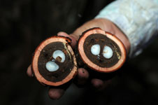
| Identification | Attalea tessmannii Burret |
| Determined by | Balslev H. |
| Identification qualifier | |
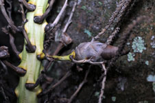
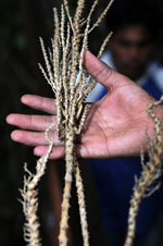
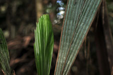
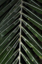
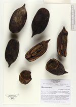
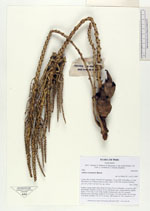
| Field notes | Solitary canopy palm. Stem about 4 m long, 60 cm in diameter, covered by old leaf sheaths. Number of leaves 15-20; leaf sheath open; lamina pinnate, slightly bushy, 9.5 m long, 2.6 m wide; number of pinnae per side 220, grouped. Infructescence interfoliar; peduncle 55 cm long, 5 cm thick; rachis 180 cm long, 4 cm thick; rachillae 120, 12-31 cm long. HB transect no. 362, subunit no. 20. |
|
 Other records of Attalea tessmannii