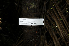
| Collector | Balslev, H. |
| Number | 7885 |
| Collected with | C. Grandez, D. Pedersen, B. Bergmann, G. del Aguila Panduro, Jim Chilo, A. Alvarado & J. Gonzales Baardales |
| Country | Peru |
| Subpart | Loreto |
| County | |
| Locality | Río Ucayali, 8 km SE of Contamana, 121 km NW of Pucallpa, ca. 2 km NE of the river. Primary forest on hilly slopes. UTM 18M: 505399; 9184476 |
| Coordinates | 7° 22' 40.4'' S 74° 57' 3.9'' W |
| Minimum elevation (m) | 194 |
| Maximum elevation (m) | 194 |
| Start date | 2009/06/05 |
| End date | 0/00/00 |
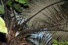
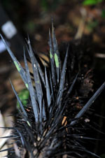
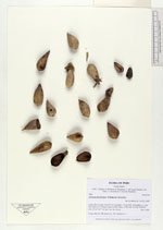
| Family | Arecaceae |
| Identification | Astrocaryum faranae F.Kahn & E.Ferreira |
| Determined by | Balslev H. |
| Identification qualifier | |
| Field notes | Fruits collected. HB transect no. 362, subunit no. 1 |
|
 Other records of Astrocaryum faranae