| Collector | Balslev, H. |
| Number | 7884 |
| Collected with | C. Grandez, D. Pedersen, B. Bergmann, G. del Aguila Panduro, Jim Chilo, A. Alvarado & J. Gonzales Baardales |
| Country | Peru |
| Subpart | Loreto |
| County | |
| Locality | Río Ucayali, 7 km SE of Contamana, 121 km NW of Pucallpa, ca. 2.5 km NE of the river. Primary forest on steep hills. UTM 18M: 504819; 9184837 |
| Coordinates | 7° 22' 28.7'' S 74° 57' 22.8'' W |
| Minimum elevation (m) | 128 |
| Maximum elevation (m) | 203 |
| Start date | 2009/06/04 |
| End date | 0/00/00 |
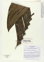
| Family | Arecaceae |
| Identification | Geonoma macrostachys var. macrostachys Mart. |
| Determined by | H. Balslev |
| Identification qualifier | |
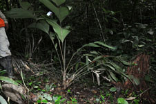
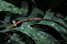
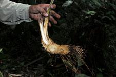
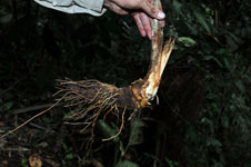
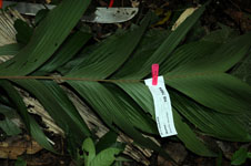
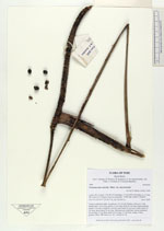
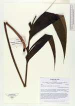
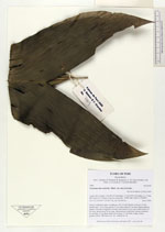
| Field notes | Solitary understory palm. Acaulecent, 160 cm tall. Number of leaves 9; leaf sheath open, 19 cm long; petiole 33 cm long; rachis 59 cm long; lamina pinnate; pinnae 5 per side, irregularly inserted, basal pinna 28 cm long, middle pinna 34 cm long, apical pinna 34 cm long. Infructescence interfoliar, spicate; peduncle 82 cm long, 0.5 cm thick; spike 28 cm long, 1.2 cm thick, orange. Fruits, globose, black. HB transect no. 361, subunit no. 80 |
|