AAU Herbarium Database |
| New Search Modify Search |
| Collector | Balslev, H. |
| Number | 7883 |
| Collected with | C. Grandez, D. Pedersen, B. Bergmann, G. del Aguila Panduro, Jim Chilo, A. Alvarado & J. Gonzales Baardales |
| Country | Peru |
| Subpart | Loreto |
| County | |
| Locality | Río Ucayali, 7 km SE of Contamana, 121 km NW of Pucallpa, ca. 2.5 km NE of the river. Primary forest on steep hills. UTM 18M: 504848; 9184805 |
| Coordinates | 7° 22' 29.7'' S 74° 57' 21.9'' W |
| Minimum elevation (m) | 128 |
| Maximum elevation (m) | 203 |
| Start date | 2009/06/04 |
| End date | 0/00/00 |
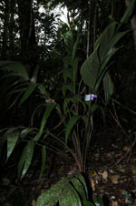
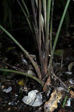
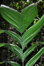
| Family | Arecaceae |
| Identification | Geonoma macrostachys var. macrostachys Mart. |
| Determined by | H. Balslev |
| Identification qualifier | |
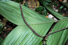
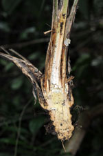
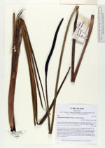
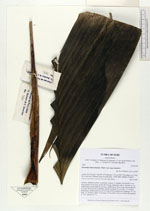
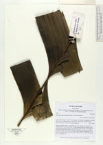
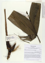
| Field notes | Solitary, understory palm. Acaulecent. Leaves 12, pinnate; leaf sheath 25 cm long; petiole 35 cm long; rachis 98 cm long; pinnae per side 5, inserted, in one single plane, basal pinna 58 cm long, middle pinna 54 cm long, apical pinna 55 cm long. Inflorescence interfoliar, spicate; prophyll 19 cm long, 1.5 cm thick, herbaceous; peduncular bract 42 cm long, brown, herbaceous; peduncle 101 cm long, 1.2 cm thick; spike 19 cm long, 0.8 cm thick. Flowers in bud. HB transect no. 361, subunit no. 71 |
| |
| Display all 220 georeferenced records of Geonoma Geonoma macrostachys var. macrostachys |
| New Search Modify Search |