| Collector | Balslev, H. |
| Number | 7881 |
| Collected with | C. Grandez, D. Pedersen, B. Bergmann, G. del Aguila Panduro, Jim Chilo, A. Alvarado & J. Gonzales Baardales |
| Country | Peru |
| Subpart | Loreto |
| County | |
| Locality | Río Ucayali, 7 km SE of Contamana, 121 km NW of Pucallpa, ca. 2.5 km NE of the river. Primary forest on steep hills. UTM 18M: 499058; 9187216 |
| Coordinates | 7° 22' 31.3'' S 74° 57' 20.4'' W |
| Minimum elevation (m) | 128 |
| Maximum elevation (m) | 203 |
| Start date | 2009/06/04 |
| End date | 0/00/00 |
| Family | Arecaceae |
| Identification | Phytelephas macrocarpa Ruiz & Pav. |
| Determined by | Balslev H. |
| Identification qualifier | |
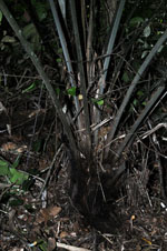
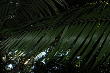
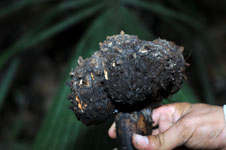
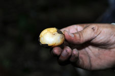
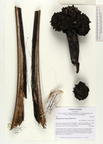
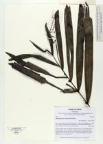
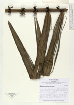
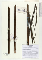
| Field notes | Solitary midstory palm. Acaulecent. Number of leaves 14; leaf sheath open, 20 cm long; petiole 175 cm long, section margined; rachis 438 cm long; lamina pinnate; pinnae regularly inserted, in one single plane, basal pinna 45 cm long, middle pinna 69 cm long, apical pinna 12 cm long. Infructescence interfoliar. HB transect no. 361, subunit no. 57 |

|
 Other records of Phytelephas macrocarpa