AAU Herbarium Database |
| New Search Modify Search |
| Collector | Balslev, H. |
| Number | 7867 |
| Collected with | C. Grandez, G. Criollo, D. Pedersen, L. Stewart, I. Nicolajsen, W. Eiserhardt, D. Lindvig |
| Country | Peru |
| Subpart | Ucayali-Atalaya |
| County | |
| Locality | Rio Ucayali, 1km W of Iparia, 104km S of Pucallpa (UTM 8968755 S; 561799 W). Rainforest on terrace, not inundated acc to local informants, with old tractor trails. |
| Coordinates | 9° 19' 43.4'' S 74° 26' 14.1'' W |
| Minimum elevation (m) | 168 |
| Maximum elevation (m) | 0 |
| Start date | 2008/10/23 |
| End date | 0/00/00 |
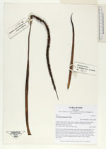
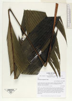
| Family | Arecaceae |
| Identification | Geonoma brongniartii Mart. |
| Determined by | H. Balslev |
| Identification qualifier | |
| Field notes | Solitary, erect, understory palm. Roots 80, 15cm long, 0.2cm thick. Stem 0.7m long, 2,5cm thick. Leaves 5 per stem, sheath 24cm, open; petiole 40cm long, margined, green; rachis 65cm; lamina 85 x 35cm; pinnae 3 per side, basal 32cm, middle 27cm, apical 26cm. Inflorescence interfoliar; peduncular bract 22cm long, soft, brown, inserted at the base; peduncle 35cm long, 0.4cm thick; rachis 30cm long, 0.5cm thick, unbranched; flowers sunken, white. Transect HB358-SU88. |
_HB7867_Geonoma_brongniartii.jpg)
_HB7867_Geonoma_brongniartii.jpg)
_HB7867_Geonoma_brongniartii.jpg)
| |
| Display all 110 georeferenced records of Geonoma Geonoma brongniartii |
| New Search Modify Search |