| Collector | Balslev, H. |
| Number | 7845 |
| Collected with | C. Grandez, G. Criollo, D. Pedersen, L. Stewart, I. Nicolajsen, W. Eiserhardt, D. Lindvig |
| Country | Peru |
| Subpart | Ucayali-Atalaya |
| County | |
| Locality | Rio Ucayali, N of outlet of Río Schahuaya (168 km S of Pucallpa), entrance to Fernando Stahl (UTM 8909890 S; 593192 W). Flood plain rainforest, mosaic of patches with tall trees and low liana tangles. |
| Coordinates | 9° 51' 37.9'' S 74° 9' .2'' W |
| Minimum elevation (m) | 179 |
| Maximum elevation (m) | 0 |
| Start date | 2008/10/21 |
| End date | 0/00/00 |
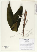
| Family | Arecaceae |
| Identification | Geonoma brongniartii Mart. |
| Determined by | H. Balslev |
| Identification qualifier | |
| Field notes | Juvenile, solitary, palm. Leaves 7 per stem; sheats 7cm, open; petiole 17cm, margined, green; rachis 20cm long; lamina 30 x 15cm entire, bifid. Sterile voucher. Transect HB354-SU70. |
_HB7845_Geonoma_brongniartii.jpg)
_HB7845_Geonoma_brongniartii.jpg)
|