| Collector | Balslev, H. |
| Number | 7816 |
| Collected with | C. Grandez, G. Criollo, D. Pedersen, L. Stewart, I. Nicolajsen, W. Eiserhardt, D. Lindvig |
| Country | Peru |
| Subpart | Ucayali-Atalaya |
| County | |
| Locality | About 180 km S of Pucallpa, 10 km to the east along a timber-road from Nueva Italia, which on a Río Ucayali oxbow (UTM 8914422 S; 624183 W). Tall rainforest on flat terrace, dominated by Lepidocaryum tenue. |
| Coordinates | 9° 49' 7.4'' S 73° 52' 3.3'' W |
| Minimum elevation (m) | 212 |
| Maximum elevation (m) | 0 |
| Start date | 2008/10/18 |
| End date | 0/00/00 |
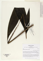
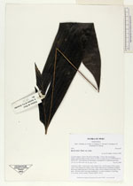
| Family | Arecaceae |
| Identification | Bactris hirta var. hirta Mart. |
| Determined by | H. Balslev |
| Identification qualifier | |
| Field notes | Understory palm. Leaves 6 per stem; sheath 12cm, closed; petiole 28cm, green; rachis 13cm; lamina 42 x 40cm, entire, bifid. Inflorescence infrafoliar; prophyll 4cm long; peduncular bract 12cm long, spiny, brown; peduncle 4cm long, 0.2cm thick , smooth; rachis 0cm long, branched to 1st order; rachillae 2, 6cm long, 0.2cm thick; flowers sessile. Transect HB351-SU01. |
|