| Collector | Balslev, H. |
| Number | 7771 |
| Collected with | C. Grandez, G. Criollo, D. Pedersen, L. Stewart, I. Nicolajsen, W. Eiserhardt, D. Lindvig |
| Country | Peru |
| Subpart | Ucayali-Atalaya |
| County | |
| Locality | About 200 km S of Pucallpa, 0.5 km of Río Ucayali, 9km S of Bolognesi (UTM 8883963 S; 612596 W). Tall floodplain rainforest, apparently on old leves separated by depressions. |
| Coordinates | 10° 5' 40.2'' S 73° 58' 20.6'' W |
| Minimum elevation (m) | 195 |
| Maximum elevation (m) | 0 |
| Start date | 2008/10/16 |
| End date | 0/00/00 |
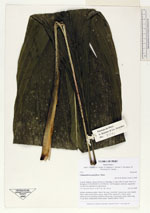
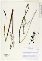
| Family | Arecaceae |
| Identification | Chamaedorea pauciflora Mart. |
| Determined by | H. Balslev |
| Identification qualifier | |
| Field notes | Solitary understory palm. Stem 0.3m long, 2cm thick. Leaves 6 per stem; sheath 28cm, open; petiole 40cm, green; rachis 57cm; lamina 87 x 33cm, entire. Infructescence interfoliar; peduncle 48cm long, 0.4cm thick; rachis 35cm long, 0.5cm thick, unbranched; fruits sessile. Transect HB347-SU09. |
_HB7771_Chamaedorea_pauciflora.jpg)
_HB7771_Chamaedorea_pauciflora.jpg)
_HB7771_Chamaedorea_pauciflora.jpg)
|