AAU Herbarium Database |
| New Search Modify Search |
| Collector | Balslev, H. |
| Number | 7701 |
| Collected with | C. Grandez, G. Criollo, D. Pedersen, L. Stewart, I. Nicolajsen, W. Eiserhardt, D. Lindvig |
| Country | Peru |
| Subpart | Junín |
| County | |
| Locality | Just N of the road along Río Tambo 5km S of Atalaya (UTM 8809648 S; 634262 W). Tall rainforest on long, not steep slope. |
| Coordinates | 10° 45' 56.9'' S 73° 46' 19.3'' W |
| Minimum elevation (m) | 418 |
| Maximum elevation (m) | 0 |
| Start date | 2008/10/11 |
| End date | 0/00/00 |
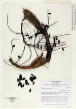
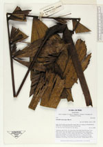
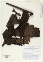
| Family | Arecaceae |
| Identification | Iriartella stenocarpa Burret |
| Determined by | H. Balslev |
| Identification qualifier | |
| Field notes | Understory palm. Roots 150, 50cm long, 0.4cm thick. Stem 8m long, 2.5cm thick. Leaves 7 per stem; sheath 33cm, closed; petiole 41cm, round, green; rachis 60cm; lamina 74 x 68cm; pinnae 6 per side, basal 17cm, middle 30cm, apical 17cm. Prophyll 17cm long; peduncular bracts 2, 26cm long, brown; peduncle 42cm long, 0.8cm thick; rachis 14cm long, branched to 1st order; rachillae 28, 20cm long, 0.4cm thick; flowers sessile. Transect HB341-SU75. |
_HB7701_Ireartella_stenocarpa.jpg)
_HB7701_Ireartella_stenocarpa.jpg)
| |
| Display all 32 georeferenced records of Iriartella Iriartella stenocarpa |
| New Search Modify Search |