| Collector | Balslev, H. |
| Number | 7659 |
| Collected with | C. Grandez, G. Criollo, D. Pedersen, L. Stewart, I. Nicolajsen, W. Eiserhardt, D. Lindvig |
| Country | Peru |
| Subpart | Ucayali-Atalaya |
| County | |
| Locality | In the crutch between Río Ucayali and Río Toniromashi 220 km S of Pucallpa (UTM 8860213 S; 609815 W). Tall forest w many Astrocaryum chonta, Attalea phalerata, and flooding marks 1.5 m above the ground. |
| Coordinates | 10° 18' 33.6'' S 73° 59' 49.5'' W |
| Minimum elevation (m) | 205 |
| Maximum elevation (m) | 0 |
| Start date | 2008/10/06 |
| End date | 0/00/00 |
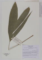
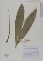
| Family | Arecaceae |
| Identification | Astrocaryum chonta Mart. |
| Determined by | H. Balslev |
| Identification qualifier | |
| Field notes | Juvenile, acaulescent palm. Leaves 9 per stem; sheath 11cm, closed; petiole 15cm, margined, green; rachis 14cm; lamina 30 x 15cm, undivided. Sterile voucher. Transect HB338-SU94. |
_HB7659_Astrocaryum_chonta.jpg)
|
 Other records of Astrocaryum chonta