| Collector | Balslev, H. |
| Number | 7658 |
| Collected with | C. Grandez, G. Criollo, D. Pedersen, L. Stewart, I. Nicolajsen, W. Eiserhardt, D. Lindvig |
| Country | Peru |
| Subpart | Ucayali-Atalaya |
| County | |
| Locality | In the crutch between Río Ucayali and Río Toniromashi 220 km S of Pucallpa (UTM 8861908 S; 609820 W). Tall forest w many Astrocaryum chonta, Attalea phalerata, and flooding marks 1.5 m above the ground. |
| Coordinates | 10° 17' 38.5'' S 73° 59' 49.5'' W |
| Minimum elevation (m) | 209 |
| Maximum elevation (m) | 0 |
| Start date | 2008/10/06 |
| End date | 0/00/00 |
| Family | Arecaceae |
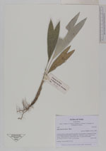
| Identification | Astrocaryum chonta Mart. |
| Determined by | H. Balslev |
| Identification qualifier | |
| Field notes | Seedling. Transect HB338-SU92. |
_HB7658_Astrocaryum_chonta.jpg)
|
 Other records of Astrocaryum chonta