| Collector | Balslev, H. |
| Number | 7656 |
| Collected with | C. Grandez, G. Criollo, D. Pedersen, L. Stewart, I. Nicolajsen, W. Eiserhardt, D. Lindvig |
| Country | Peru |
| Subpart | Ucayali-Atalaya |
| County | |
| Locality | In the crutch between Río Ucayali and Río Toniromashi 220 km S of Pucallpa (UTM 8859908 S; 610134 W). Tall forest w many Astrocaryum chonta, Attalea phalerata, and flooding marks 1.5 m above the ground. |
| Coordinates | 10° 18' 43.5'' S 73° 59' 39'' W |
| Minimum elevation (m) | 200 |
| Maximum elevation (m) | 0 |
| Start date | 2008/10/06 |
| End date | 0/00/00 |
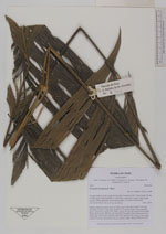
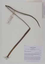
| Family | Arecaceae |
| Identification | Geonoma brongniartii Mart. |
| Determined by | H. Balslev |
| Identification qualifier | |
| Field notes | Solitary understory palm. Roots 8, 20cm long, 0.2cm thick. Stem 0.3m long, 3cm thick. Leaves 11 per stem; sheath 37cm, closed; petiole 70cm margined, green; rachis 70cm; lamina 95 x 48cm; pinnae 4-6 per side, basal 36cm, middle 33cm, apical 30cm. Inflorescence interfoliar; prophyll 26cm; peduncular bract 38cm long, soft, brown, inserted at the base; peduncle 59cm long, 0.4cm thick; rachis 32cm long, unbranched; flowers sunken, white. Transect HB338-SU08. |
_HB7656_Geonoma_brongniartii.jpg)
_HB7656_Geonoma_brongniartii.jpg)
_HB7656_Geonoma_brongniartii.jpg)
_HB7656_Geonoma_brongniartii.jpg)
_HB7656_Geonoma_brongniartii.jpg)
_HB7656_Geonoma_brongniartii.jpg)
|