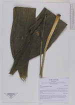
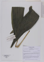
| Collector | Balslev, H. |
| Number | 7573 |
| Collected with | C. Grandez, G. Criollo, D. Pedersen, L. Stewart, I. Nicolajsen, W. Eiserhardt, D. Lindvig |
| Country | Peru |
| Subpart | Ucayali-Atalaya |
| County | |
| Locality | Fernando Estál on Río Schahuaya, 169km S of Pucallpa (UTM 8907884 S; 588448 W). Rain forest on flat land just below hills, less than 1 km N of village. |
| Coordinates | 9° 52' 43.6'' S 74° 11' 35.8'' W |
| Minimum elevation (m) | 192 |
| Maximum elevation (m) | 0 |
| Start date | 2008/09/29 |
| End date | 0/00/00 |
| Family | Arecaceae |
| Identification | Chamaedorea pauciflora Mart. |
| Determined by | H. Balslev |
| Identification qualifier | |
| Field notes | Solitary understory palm. Roots 25, 8cm long, 0.2cm thick. Stem 0.3 m long, 2.5cm thick. Leaves 6 per stem; sheath 28cm; petiole 24cm, green; rachis 64cm; lamina 107 x 42cm wide, entire. Peduncle 57cm, 0.7cm thick; rachis 46cm, unbranched. Transect HB330-SU77 |
|