AAU Herbarium Database |
| New Search Modify Search |
| Collector | Balslev, H. |
| Number | 7502 |
| Collected with | M. Kronborg, G. Criollo |
| Country | Peru |
| Subpart | Loreto |
| County | |
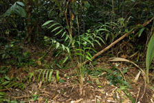
| Locality | Río Nanay ca. 22km. up river from Puca Urco. Entered a small river on the left hand side going down river and walked 2km. NNE. 07km W of Iquitos. Tropical rain forest on hills. Transect #315. (UTM 18M: 0587890;9594060). |
| Coordinates | 3° 40' 20.151'' S 74° 12' 30.836'' W |
| Minimum elevation (m) | 125 |
| Maximum elevation (m) | 0 |
| Start date | 2007/12/06 |
| End date | 0/00/00 |
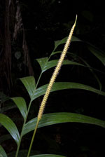
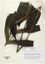
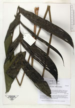
| Family | Arecaceae |
| Identification | Geonoma macrostachys var. acaulis (Mart.)A.J.Hend. |
| Determined by | |
| Identification qualifier | |
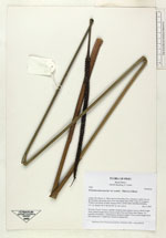
| Field notes | No stem. Crown: 8 leaves, petioles round in cross-section. Leaves: sheath length 16cm, petiole length 70cm, lamina length 58cm and 50cm wide. Pinnae: 14, regularly distributed. 1 inflorescence: peduncle length 127cm, rachis length 26cm and unbranched. 2 duplicates. Found in subunit 010. |
| |
| Display all 211 georeferenced records of Geonoma Geonoma macrostachys var. acaulis |
| New Search Modify Search |