AAU Herbarium Database |
| New Search Modify Search |
| Collector | Balslev, H. |
| Number | 7499 |
| Collected with | M. Kronborg, G. Criollo |
| Country | Peru |
| Subpart | Loreto |
| County | |
| Locality | Río Nanay ca. 22km. upriver from Puca Urco. Entered a small river on the left hand side going down river and walked ca. 1km. 107km W of Iquitos. Tropical rain forest on white sand. Outside transect #314. (UTM 18M: 0587683;9593701). |
| Coordinates | 3° 40' 31.848'' S 74° 12' 37.536'' W |
| Minimum elevation (m) | 130 |
| Maximum elevation (m) | 0 |
| Start date | 2007/12/06 |
| End date | 0/00/00 |
| Family | Arecaceae |
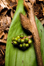
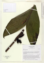
| Identification | Bactris hirta Mart. |
| Determined by | |
| Identification qualifier | |
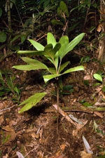
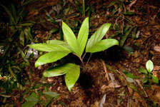
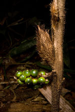
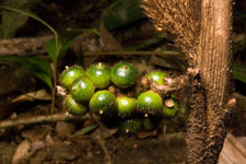
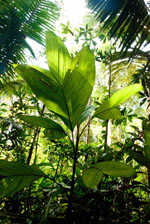
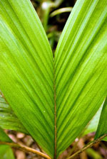
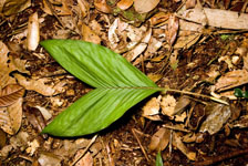
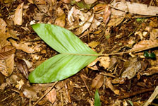
| Field notes | Stem 44cm long and 1cm thick with spines on the surface. 7 leaves distributed evenly on the height of the entire palm, petioles round in cross-section. Leaves: sheath length 3cm, petiole length 12cm, lamina length 32cm and 22cm wide. Leaves are bifid. 1 infructescence (green fruits): peduncle bract length 6cm and 2cm wide (woody with hair on the surface), peduncle length 0.5cm, rachis length 4cm and unbranched. 2 duplicates. Found near subunit 043. |
| |
 Other records of Bactris hirta Other records of Bactris hirtaThe map displays only records from the Aarhus Herbarium Database. The records may not represent the full distribution of Bactris hirta |
| New Search Modify Search |