| Collector | Balslev, H. |
| Number | 7495 |
| Collected with | M. Kronborg, G. Criollo |
| Country | Peru |
| Subpart | Loreto |
| County | |
| Locality | Río Nanay ca. 30km. from Puca Urco up river. Right side of river going down. 118km W of Iquitos. Tropical rain forest on hills. Transect #311. (UTM 18M: 0577299;9594989). |
| Coordinates | 3° 39' 50.184'' S 74° 18' 14.174'' W |
| Minimum elevation (m) | 180 |
| Maximum elevation (m) | 0 |
| Start date | 2007/12/04 |
| End date | 0/00/00 |
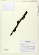
| Family | Arecaceae |
| Identification | Bactris hirta var. hirta Mart. |
| Determined by | |
| Identification qualifier | |
| Field notes | Stem 110cm long and 0.5cm thick with spines on the surface. Crown: 6 leaves, petioles rounded below and flat above. Leaves: sheath length 18cm, petiole length 26cm, lamina length 46cm and 18cm wide. Leaves are bifid with scales on the surface. Palm is sterile. 2 duplicates. Found in subunit 065. |
|