AAU Herbarium Database |
| New Search Modify Search |
| Collector | Balslev, H. |
| Number | 7492 |
| Collected with | M. Kronborg, G. Criollo |
| Country | Peru |
| Subpart | Loreto |
| County | |
| Locality | Río Nanay ca. 30km. from Puca Urco up river. Right side of river going down. 118km W of Iquitos. Tropical rain forest on hills. Transect #311. (UTM 18M: 0577299;9594989). |
| Coordinates | 3° 39' 50.184'' S 74° 18' 14.174'' W |
| Minimum elevation (m) | 180 |
| Maximum elevation (m) | 0 |
| Start date | 2007/12/04 |
| End date | 0/00/00 |
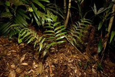
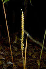
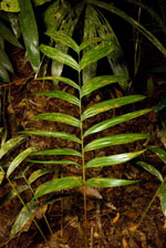
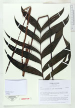
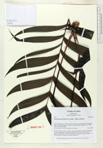
| Family | Arecaceae |
| Identification | Geonoma macrostachys var. acaulis (Mart.)A.J.Hend. |
| Determined by | |
| Identification qualifier | |
| Field notes | No stem. Crown: 6 leaves, petioles round in cross-section. Leaves: sheath length 12cm, petiole length 50cm, lamina length 46cm and 35cm wide. Pinnae: 20, regularly distributed. 1 inflorescence: peduncle length 41cm, rachis length 11cm and unbranched. 2 duplicates. Found in subunit 014. |
| |
| Display all 211 georeferenced records of Geonoma Geonoma macrostachys var. acaulis |
| New Search Modify Search |