AAU Herbarium Database |
| New Search Modify Search |
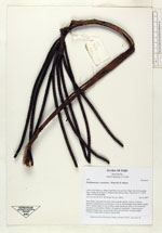
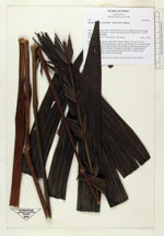
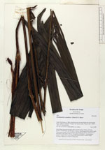
| Collector | Balslev, H. |
| Number | 7491 |
| Collected with | M. Kronborg, G. Criollo |
| Country | Peru |
| Subpart | Loreto |
| County | |
| Locality | Río Nanay ca. 30km. from Puca Urco up river. Right side of river going down. 118km W of Iquitos. Tropical rain forest on hills. Transect #311. (UTM 18M: 0577299;9594989). |
| Coordinates | 3° 39' 50.184'' S 74° 18' 14.174'' W |
| Minimum elevation (m) | 180 |
| Maximum elevation (m) | 0 |
| Start date | 2007/12/04 |
| End date | 0/00/00 |
| Family | Arecaceae |
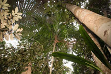
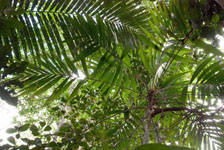
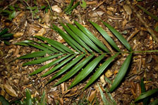
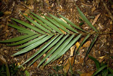
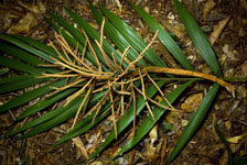
| Identification | Pholidostachys synanthera subsp. robusta (Trail) A.J.Hend. |
| Determined by | A. Henderson |
| Identification qualifier | |
| Field notes | Stem 420cm long and 4cm thick with a smooth surface. Crown: 14 leaves, petioles rounded below and flat above. Leaves: sheath length 42cm, petiole length 76cm, lamina length 131cm and 85cm wide. Sheath and petiole with numerous red scales on the surface. Pinnae: 26, regularly distributed. 1 infructescence: peduncle length 42cm, rachis length 50cm and branched, rachillae length 13-23cm. 3 duplicates. Found in subunit 003. |
| |
 Other records of Pholidostachys synanthera subsp. robusta Other records of Pholidostachys synanthera subsp. robustaThe map displays only records from the Aarhus Herbarium Database. The records may not represent the full distribution of Pholidostachys synanthera subsp. robusta |
| New Search Modify Search |