AAU Herbarium Database |
| New Search Modify Search |
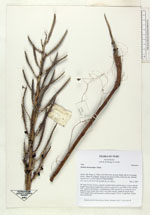
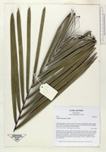
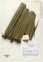
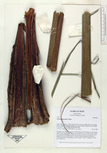
| Collector | Balslev, H. |
| Number | 7490 |
| Collected with | M. Kronborg, G. Criollo |
| Country | Peru |
| Subpart | Loreto |
| County | |
| Locality | Río Nanay ca. 30km. from Puca Urco up river. Right side of river going down. 118km W of Iquitos. Tropical rain forest on hills wwith red clay. Outside transect #311. (UTM 18M: 0577299;9594989). |
| Coordinates | 3° 39' 50.184'' S 74° 18' 14.174'' W |
| Minimum elevation (m) | 180 |
| Maximum elevation (m) | 0 |
| Start date | 2007/12/04 |
| End date | 0/00/00 |
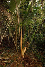
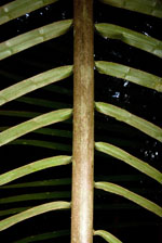
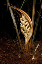
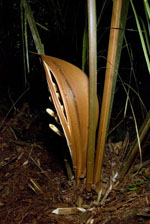
| Family | Arecaceae |
| Identification | Attalea microcarpa Mart. |
| Determined by | |
| Identification qualifier | |
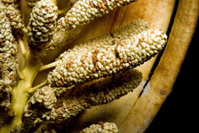
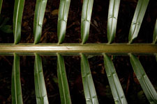
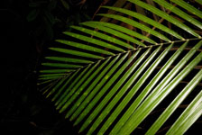
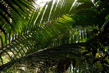
| Field notes | No stem. Crown: 6 leaves, petioles rounded below and flat above. Leaves: sheath length 20cm, petiole length 40cm, lamina length 631cm and 186cm wide. Pinnae: 252, regularly distributed. 1 infructescence (still enclosed in its peduncle bract): peduncle bract length 84cm and 31cm wide (woody), peduncle length 28cm, rachis length 40cm and branched, rachillae length 7-13cm. 2 duplicates. Found near subunit 002. |
| |
 Other records of Attalea microcarpa Other records of Attalea microcarpaThe map displays only records from the Aarhus Herbarium Database. The records may not represent the full distribution of Attalea microcarpa |
| New Search Modify Search |