AAU Herbarium Database |
| New Search Modify Search |
| Collector | Balslev, H. |
| Number | 7381 |
| Collected with | M. Kronborg, G. Criollo |
| Country | Peru |
| Subpart | Loreto |
| County | |
| Locality | Río Ucayali Jenaro Herrera 135km SSW of Iquitos. Tropical rain forest on hills. Transect #284. (UTM 18M: 0651738;9458561). |
| Coordinates | 4° 53' 49.375'' S 73° 37' 53.528'' W |
| Minimum elevation (m) | 175 |
| Maximum elevation (m) | 0 |
| Start date | 2007/11/14 |
| End date | 0/00/00 |
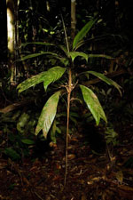
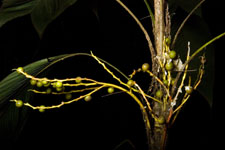
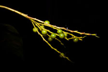
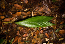
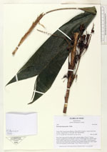
| Family | Arecaceae |
| Identification | Geonoma leptospadix Trail |
| Determined by | |
| Identification qualifier | |
| Field notes | Stem 76cm long and 0.5cm thick with a smooth surface. Crown: 17 leaves, petioles rounded below and flat above. Leaves: sheath length 8cm, petiole length 10cm, lamina length 19cm and 12cm wide. Leaves are bifid. 3 infructescences: peduncular bract length 5cm and 0.5cm wide, peduncle length 9cm, rachis length 10cm and branched, rachillae length 7-8cm. Found in subunit 061. |
| |
| Display all 26 georeferenced records of Geonoma Geonoma leptospadix |
| New Search Modify Search |