AAU Herbarium Database |
| New Search Modify Search |
| Collector | Balslev, H. |
| Number | 7330 |
| Collected with | M. Kronborg, G. Criollo |
| Country | Peru |
| Subpart | Loreto |
| County | |
| Locality | Río Tigre. N of pueblo Manchuria; 25 km of outlet from Río Corrientes. Left hand side going down river. 121km W of Iquitos. Tropical rain forest on hills with red clay. Transect #275. (UTM 18M: 0574374;9575994). |
| Coordinates | 3° 50' 8.861'' S 74° 19' 48.519'' W |
| Minimum elevation (m) | 175 |
| Maximum elevation (m) | 0 |
| Start date | 2007/11/03 |
| End date | 0/00/00 |
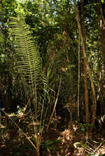
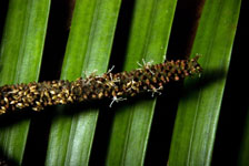
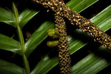
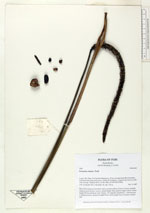
| Family | Arecaceae |
| Identification | Geonoma camana Trail |
| Determined by | |
| Identification qualifier | |
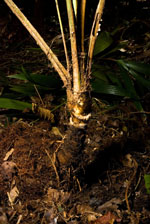
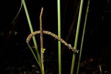
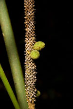
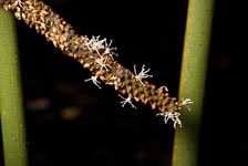
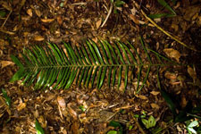
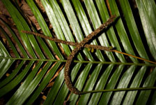
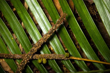
| Field notes | Stem 23cm long and 5cm thick with a smooth surface. Crown: 6 leaves, petioles round in cross-section. Leaves: sheath length 30cm, petiole length 102cm, lamina length 207cm and 66cm wide. Pinnae: 156, regularly distributed. 1 inflorescence (1 infructescence): peduncle length 67cm, rachis length 25cm. Found in subunit 039. |

| |
| Display all 57 georeferenced records of Geonoma Geonoma camana |
| New Search Modify Search |