AAU Herbarium Database |
| New Search Modify Search |
| Collector | Balslev, H. |
| Number | 7320 |
| Collected with | M. Kronborg, G. Criollo |
| Country | Peru |
| Subpart | Loreto |
| County | |
| Locality | Río Tigre. Ca. 18 km E of inlet to Río Corrientes; left hand side going down river. 125km W of Iquitos. Tropical rain forest on hills with red clay. Transect #273. (UTM 18M: 0569576;9583935). |
| Coordinates | 3° 45' 50.365'' S 74° 22' 24.268'' W |
| Minimum elevation (m) | 175 |
| Maximum elevation (m) | 0 |
| Start date | 2007/11/02 |
| End date | 0/00/00 |
| Family | Arecaceae |
| Identification | Pholidostachys synanthera subsp. robusta (Trail) A.J.Hend. |
| Determined by | A. Henderson |
| Identification qualifier | |
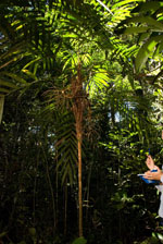
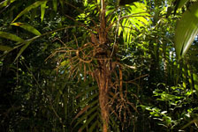
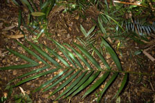
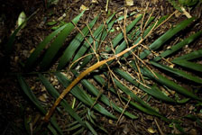
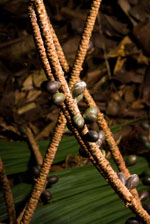
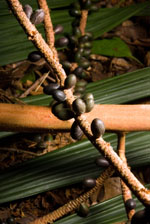
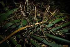
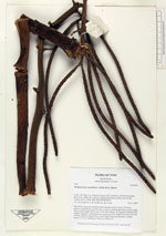
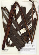
| Field notes | Stem 267cm long and 4cm thick with a smooth surface. Crown: 18 leaves, petioles rounded below and flat above. Leaves: sheath length 74cm, petiole length 36cm, lamina length 183cm and 111cm wide. Pinnae: 26, regularly distributed but slightly staggered. 2 infructescences: peduncular bract length 41cm and 7cm wide (woody), peduncle length 59cm, rachis length 36cm and branched, rachillae length 21-31cm. 3 duplicates. Found in subunit 027. |
| |
 Other records of Pholidostachys synanthera subsp. robusta Other records of Pholidostachys synanthera subsp. robustaThe map displays only records from the Aarhus Herbarium Database. The records may not represent the full distribution of Pholidostachys synanthera subsp. robusta |
| New Search Modify Search |