AAU Herbarium Database |
| New Search Modify Search |
| Collector | Balslev, H. |
| Number | 7297 |
| Collected with | M. Kronborg, G. Criollo |
| Country | Peru |
| Subpart | Loreto |
| County | |
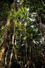
| Locality | Río Tigre ca. 15 km SW of Intuto. Left hand side going down river.150km W of Iquitos. Tropical rain forest on hills with red clay. Transect #267. (UTM 18M: 0545903;9599267). |
| Coordinates | 3° 37' 31.49'' S 74° 35' 11.988'' W |
| Minimum elevation (m) | 140 |
| Maximum elevation (m) | 0 |
| Start date | 2007/10/30 |
| End date | 0/00/00 |
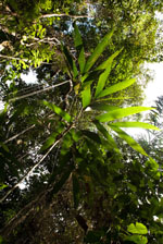
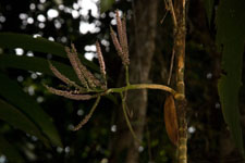
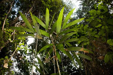
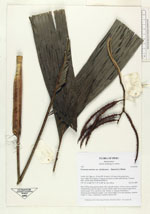
| Family | Arecaceae |
| Identification | Geonoma maxima var. chelidonura (Spruce)A.J.Hend. |
| Determined by | |
| Identification qualifier | |
| Field notes | Stem 378cm long and 2cm thick with a smooth surface. Crown: 6 leaves, petioles rounded below and flat above. Leaves: sheath length 11cm, petiole length 36cm, lamina length 75cm and 42cm wide. Pinnae: 4, regularly distributed. 1 infructescence: Peduncle length 11cm, rachis length 21cm and branched, rachillae length 11-13cm. 3 duplicates. Found in subunit 004. |
| |
| Display all 45 georeferenced records of Geonoma Geonoma maxima var. chelidonura |
| New Search Modify Search |