| Collector | Balslev, H. |
| Number | 7168 |
| Collected with | G. Criollo, C. Grandez & T. Kristiansen |
| Country | Peru |
| Subpart | Loreto |
| County | |
| Locality | Río Napo left bank going down river, between San Felipe and Paleta (both) right bank and ca. 10 km upstream from Negro Urco. Floodplain forest w. low density of tall, thick trees. Holocene floodplain sediments. (UTM 18m;06744577;9674236). Transect 248 |
| Coordinates | 2° 56' 46'' S 73° 25' 49'' W |
| Minimum elevation (m) | 0 |
| Maximum elevation (m) | 0 |
| Start date | 2006/10/20 |
| End date | 0/00/21 |
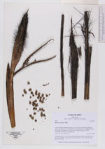
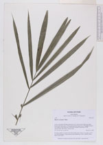
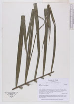
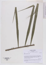
| Family | Arecaceae |
| Identification | Bactris concinna Mart. |
| Determined by | |
| Identification qualifier | |
| Field notes | Forming stands in wet parts of the flood plain forest. Stems to 4 m tall. Lvs 4-5 per stem, spreading. Young infructescence infrafoliar. (AAU+AMAZ). Photo DSCN 2992-2994 |
|