| Collector | Balslev, H. |
| Number | 7027 |
| Collected with | T. Kristiansen, D. K. Andersen, C. Grandez & G. Criollo |
| Country | Peru |
| Subpart | Loreto |
| County | |
| Locality | On Río Pintuyacu, 22 km upriver of the outlet of Río Chambira. Primary tropical rain forest, quite open w. many palms (UTM (ca. 250 m NE from start of transect) 18M;0613174;9598850). Transect # 225 |
| Coordinates | 3° 37' 43'' S 73° 58' 51'' W |
| Minimum elevation (m) | 120 |
| Maximum elevation (m) | 150 |
| Start date | 2006/03/19 |
| End date | 0/00/00 |
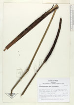
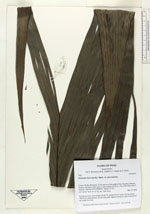
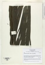
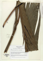
| Family | Arecaceae |
| Identification | Geonoma macrostachys var. macrostachys Mart. |
| Determined by | |
| Identification qualifier | |
| Field notes | Acaulescent. Lvs 16 in rosette; sheath 35; petiole 30 cm; rachis 150 cm; lamina 198x32 cm; blade plicate; petiole and rachis slightly tomentose, light. Peduncle 87 cm; rachis 24x2 cm |


|