| Collector | Balslev, H. |
| Number | 6985 |
| Collected with | T. Kristiansen, D. K. Andersen, C. Grandez & G. Criollo |
| Country | Peru |
| Subpart | Loreto |
| County | |
| Locality | 15-20 km up river from Comunidad Nuevo Libertad on Río Manití, ca. 45 km SE of Iquitos. Primary tropical rain forest on terra firme. (UTM 18M;0730936;9569470). Transect # 217 |
| Coordinates | 3° 53' 33'' S 72° 55' 13'' W |
| Minimum elevation (m) | 120 |
| Maximum elevation (m) | 150 |
| Start date | 2006/03/05 |
| End date | 0/00/00 |
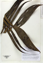
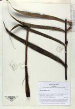
| Family | Arecaceae |
| Identification | Geonoma camana Trail |
| Determined by | |
| Identification qualifier | |
| Field notes | Solitary, stem 1.2 m. Leaf sheath 20 cm; petiole 70 cm; lamina 120x60; pinnae 28 per side, regularly inserted, apical pinnae much larger than the rest. Peduncle 5.5 cm; rachis 23 cm; fruits 0.8x1 cm; prophyll 28 cm; peduncular bract 40 cm |


|