| Collector | Balslev, H. |
| Number | 6967 |
| Collected with | T. Kristiansen, D. K. Andersen, C. Grandez & G. Criollo |
| Country | Peru |
| Subpart | Loreto |
| County | |
| Locality | Comunidad El Chino on Río Tahuayo, ca. 70 km S of Iquitos, 2-4 km S of the village. Tropical rain forest on low river terrace. (Transect # 214: UTM 18M;0698790;9522176. Transect # 215 UTM 18M; 0699292;9521894). |
| Coordinates | 4° 19' 14'' S 73° 12' 31'' W |
| Minimum elevation (m) | 120 |
| Maximum elevation (m) | 150 |
| Start date | 2006/02/23 |
| End date | 0/00/00 |
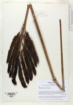
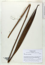
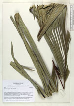
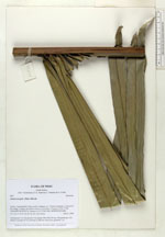
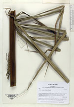
| Family | Arecaceae |
| Identification | Attalea insignis (Mart.)Drude |
| Determined by | |
| Identification qualifier | |
| Field notes | Acaulescent. Lvs 4-8; petiole 2 m; lamina 400-500x130 cm; 108 pinnae per side, pinnae in groups of 5-8, pointing in different directions; peduncle 1 m |
|
 Other records of Attalea insignis