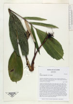
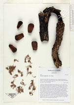
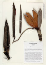
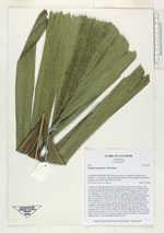
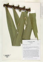
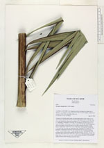
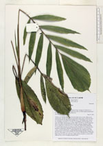
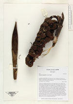
| Field notes | "Solitary tree forming small stands on steep slopes and on rocky walls in river canyons; the collected specimen growing in deep organic layer on hill top. Stem 4-5 m tall (fertile) but others seen reaching 8 m, 6-7 cm diameter, grey. Leaves 4-5, spreading, crownshaft 76 cm long, 8-6 cm diameter; petiole round, 20 cm long, with shallow adaxial groove at base; blade 270x140 cm, with 49 pinnae per side, in one plane on each side but the two sides sometimes hanging in older leaves, young leaves with brown cover of fine hairs. Inflorescences infrafoliar, 5-7 at each node, but only one mature per node, sometimes two mature per stem, pendulous, unbranched. Staminate when flowering with two bracts forming a ""roof"" over the inflorescence. Young pistillate not seen. Infructescence with persisting bracts with involute margins; the fruits forming one thick, sausage-like structure, when mature 15x7 cm to 32x11 cm in size; individual fruits of irregular shape, from 1x2 cm to 2x3 cm in size, surface uneven, smooth, or covered with redbrown hairs; petals emerging among the fruits." |
 Other records of Wettinia longipetala