AAU Herbarium Database |
| New Search Modify Search |
| Collector | Balslev, H. |
| Number | 6530 |
| Collected with | Calderon, S. |
| Country | Ecuador |
| Subpart | LOJA |
| County | |
| Locality | Mountain range "Contrafuerte Cabeza de Toro", 80 km W of Loja, ca. 10 km N of Mercadillo, 4 km past a village called El Palmar. Montane cloud forest fragment with abundant epiphytes. |
| Coordinates | 4° 0' S 79° 57' W |
| Minimum elevation (m) | 1800 |
| Maximum elevation (m) | 1800 |
| Start date | 2000/08/12 |
| End date | 2000/08/12 |
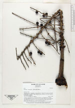
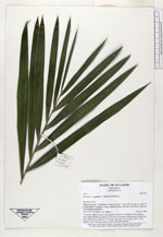
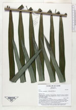
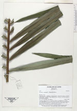
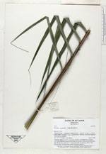
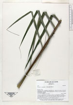
| Family | Arecaceae |
| Identification | Prestoea acuminata var. acuminata (Willd.)H.E.Moore |
| Determined by | |
| Identification qualifier | |
| Field notes | "Cespitose, stem 5 m tall, 5 cm diameter, leaves 6, crownshaft 40 cm, petiole short, blade 200x90 cm; pinnae 45 per side, in one plane. Infructescence infrafoliar, erect, 60 cm long, peduncle 15 cm long, red; rachis 45 cm long, yellow; fruits globose, black. Growing along a creek. Vernacular palmillo." |

| |
| Display all 36 georeferenced records of Prestoea Prestoea acuminata var. acuminata |
| New Search Modify Search |