AAU Herbarium Database |
| New Search Modify Search |
| Collector | Balslev, H. |
| Number | 6516 |
| Collected with | |
| Country | Ecuador |
| Subpart | ZAMORA-CHINCHIPE |
| County | |
| Locality | Parque Nacional Podocarpus at Bombuscare 5 km S of Zamora town. Montane forest on steep slopes towards Río Bombuscar a growing on very light brown (almost white) gravelly sand. |
| Coordinates | 4° 7' S 78° 58' W |
| Minimum elevation (m) | 960 |
| Maximum elevation (m) | 960 |
| Start date | 2000/08/06 |
| End date | 2000/08/06 |
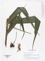
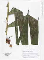
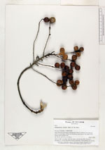
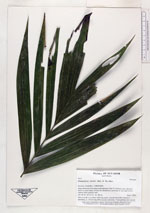
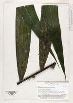
| Family | Arecaceae |
| Identification | Chamaedorea linearis (Ruiz & Pav.)Mart. |
| Determined by | |
| Identification qualifier | |
| Field notes | Stem 3 m tall, 4 cm diam, with long, green, smooth internodes. Leaves 4, spreading, ca. 120 cm long. Infructescence infrafoliar. Fruits globose, red, smooth. |
| |
| Display all 110 georeferenced records of Chamaedorea Chamaedorea linearis |
| New Search Modify Search |