AAU Herbarium Database |
| New Search Modify Search |
| Collector | Balslev, H. |
| Number | 6465 |
| Collected with | Rios, M. and G. Quezada |
| Country | Ecuador |
| Subpart | NAPO |
| County | |
| Locality | Sta. Rita W of Archidona. Montane forest. |
| Coordinates | 0° 52' S 77° 48' W |
| Minimum elevation (m) | 800 |
| Maximum elevation (m) | 1130 |
| Start date | 1996/08/12 |
| End date | 1996/08/12 |
| Family | Arecaceae |
| Identification | Prestoea carderi Hook.f. |
| Determined by | |
| Identification qualifier | |
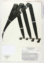
| Field notes | Two stems, clustered, 1.5-2 m tall, 4 cm diam. Lvs. 6, sheaths ca 60 cm long, petiole 64-78 cm, rachis 155 cm, pinnae 35 per side. "Kinkimí" in Shuar, palm-heart edible. This species was very abundant, especially on the higher parts of the trail north of Santa Rosa, but absent at the lower parts of the trail during 4 days walking between "18 de Febrero" and Untsuants. |
| |
 Other records of Prestoea carderi Other records of Prestoea carderiThe map displays only records from the Aarhus Herbarium Database. The records may not represent the full distribution of Prestoea carderi |
| New Search Modify Search |