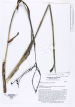
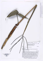
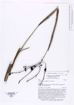
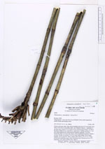
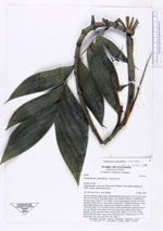
| Field notes | Solitary understory palm. Base with adventitious roots up to 0.5 cm in diam. Stem 140 cm from base to crownshaft, diam 1 cm. Number of leaves 7. Leafsheath 19 cm long, green, closed 9.5 cm. Petiole 18 cm, round except for basal 7 cm that is flat above. Rachis 42 cm, round below, angled above. Number of pinnae 4 - 5 per side; pinnae sigmoid erect. Infructescence infrafoliar, peduncle 75 cm long. Peduncular bract 5 to 45 cm long, brown, wilted, sheathing the peduncle. Rachis 3 cm long. Number of rachillae 4, to 19 cm long, bright orange. Fruits orange, elongate, curved, immature. Black, oblique when mature, 1.3 x 0.9 cm. Young inflorescence interfoliar, green, with 4 sheathing bracts. Chromosome test # 29. Duplicates: AAU, QCA, QCNE, COL. Dupl. 6. |