AAU Herbarium Database |
| New Search Modify Search |
| Collector | Balslev, H. |
| Number | 62515 |
| Collected with | Galeano, G. & Bernal, R. & Bergmann, B. |
| Country | Ecuador |
| Subpart | PICHINCHA |
| County | |
| Locality | New road from Quito to Santo Domingo, ca. 10 km east of Alluriquin. Montane rain forest. |
| Coordinates | 0° 20' S 78° 53' W |
| Minimum elevation (m) | 1125 |
| Maximum elevation (m) | 1125 |
| Start date | 1987/05/12 |
| End date | 1987/05/12 |
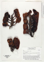
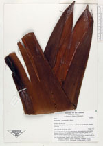
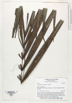
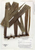
| Family | Arecaceae |
| Identification | Phytelephas aequatorialis Spruce |
| Determined by | |
| Identification qualifier | |
| Field notes | Solitary. Stem 4 m tall, 25 cm in diam, brown, with conspicuous scars spirally disposed. Leaves ca. 20, spreading; rachis 426 cm long, green; pinnae 109 on eachside, regularly disposed, patulae. Male inflorescence ca. 135 cm long, 10 cm wide, at anthesis yellowish-white visited by numerous insects; prophyll ca. 90 cm long, brownish-orange. |
| |
 Other records of Phytelephas aequatorialis Other records of Phytelephas aequatorialisThe map displays only records from the Aarhus Herbarium Database. The records may not represent the full distribution of Phytelephas aequatorialis |
| New Search Modify Search |